
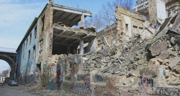
Earthquake Risk Assessment
Earthquake risk assessment is a process that involves the evaluation and analysis of the potential hazards and risks associated with earthquakes in a specific area. It entails studying the seismic activity, historical earthquake data, and geological characteristics of the region to determine the likelihood and potential impact of future earthquakes. Through this assessment, experts can identify vulnerable areas, infrastructure, and populations that may be at higher risk and develop strategies to minimize the potential damage and loss of life. This may include implementing building codes and regulations, improving emergency response systems, and educating communities on earthquake preparedness. The aim of earthquake risk assessment is to enhance resilience and ensure the safety of individuals and communities in earthquake-prone regions.
Selected projects
Assessment of Seismic Performance of Social and Administrative Buildings (42 structures) in Karakaya Hydroelectric Power Plant in accordance with Turkish Earthquake Code (TEC 2018), The Electricity Generation Company (Elektrik Üretim A.Ş. or EÜAŞ) (Directorate General of Construction and Expropriations), Project Director, 2020.
Rapid earthquake risk assessment of 1098 structures (14.60 ha) located within the boundaries of 2 neighborhood (İstiklal and Hacı Ahmet Districts) at Beyoğlu District (İstanbul) by using primary assessment (rapid assessment method) defined in Annex-A of the Regulation on the Implementation of Law no. 6306 and detailed risk assesment of selected sampling in accordance with the Circular on Detection of Risky Buildings (RYTE, 2013) given in Annex-2 of the Regulation on the Implementation of Law no. 6306, Beyoğlu/İstanbul Municipality, Project Director, 2017.
Rapid earthquake risk assessment of 1037 structures (50.50 ha) located within the boundaries of 2 neighbourhood (Çakmak and Yaprak Districts) at Şehitkamil district (Gaziantep) by using primary assessment (rapid assessment method) defined in Annex-A of the Regulation on the Implementation of Law no. 6306 and detailed risk assesment of selected sampling in accordance with the Circular on Detection of Risky Buildings (RYTE, 2013) given in Annex-2 of the Regulation on the Implementation of Law no. 6306, Gaziantep Metropolitan Municipality, Project Director, 2017.
Rapid earthquake risk assessment of 5210 structures (404.07 ha) located within the boundaries of 8 neighbourhood (Barbaros, Başak, Cudi, Karşıyaka, Nuh, Şehit Harun Boy, Yenişehir and Yeşiltepe Districts) at Silopi district (Şırnak) by using primary assessment (rapid assessment method) defined in Annex-A of the Regulation on the Implementation of Law no. 6306 and detailed risk assesment of selected sampling in accordance with the Circular on Detection of Risky Buildings (RYTE, 2013) given in Annex-2 of the Regulation on the Implementation of Law no. 6306, Ministry of Environment and Urbanization (Directorate General for Infrastructure and Urban Transformation Services), Project Director, 2016.
Rapid earthquake risk assessment of 2194 structures (550.00 ha) located at Central Niğde Province by using primary assessment (rapid assessment method) defined in Annex-A of the Regulation on the Implementation of Law no. 6306 and detailed risk assessment of selected sampling in accordance with the Circular on Detection of Risky Buildings (RYTE, 2013) given in Annex-2 of the Regulation on the Implementation of Law no. 6306, Ministry of Environment and Urbanization (Directorate General for Infrastructure and Urban Transformation Services), Project Director, 2016.
Rapid earthquake risk assessment of 5585 structures (123.25 ha) located within the boundaries of 6 neighborhood (Fetihtepe, Kaptanpaşa, Keçeci Piri, Kulaksız, Piri Paşa and Piyale Districts) at Okmeydanı area of Beyoğlu district (İstanbul) by using primary assessment (rapid assessment method) defined in Annex-A of the Regulation on the Implementation of Law no. 6306 and detailed risk assesment of selected sampling in accordance with the Circular on Detection of Risky Buildings (RYTE, 2013) given in Annex-2 of the Regulation on the Implementation of Law no. 6306, Ministry of Environment and Urbanization (Directorate General for Infrastructure and Urban Transformation Services), Project Director, 2016.
Rapid earthquake risk assessment of 2622 structures located within the boundaries of 3 neighborhood (Karayolları, Mevlana, Bağlarbaşı, Sarıgöl-Yenidoğan, Yıldıztabya and Pazariçi Districts) at Gaziosmanpaşa District (İstanbul) by using primary assessment (rapid assessment method) defined in Annex-A of the Regulation on the Implementation of Law no. 6306 and detailed risk assessment of selected sampling in accordance with the Circular on Detection of Risky Buildings (RYTE, 2013) given in Annex-2 of the Regulation on the Implementation of Law no. 6306, Gaziosmanpaşa/İstanbul Municipality, Project Director, 2016.
Rapid earthquake risk assessment of 31315 structures (1173.00 ha) located within the boundaries of 3 neighbourhood (Sarıgöl, Bağlarbaşı and Yenidoğan Ahmet Districts) at Gaziosmanpaşa District (İstanbul) by using primary assessment (rapid assessment method) defined in Annex-A of the Regulation on the Implementation of Law no. 6306 and detailed risk assessment of selected sampling in accordance with the Circular on Detection of Risky Buildings (RYTE, 2013) given in Annex-2 of the Regulation on the Implementation of Law no. 6306, Gaziosmanpaşa/İstanbul Municipality, Project Director, 2015.